Links to mapping and motorcycle pages I find interesting, useful or instructional. TBD
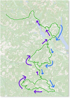
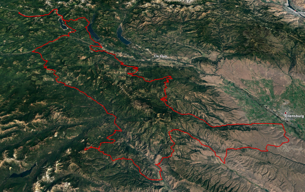
Central Cascades Grand Tour
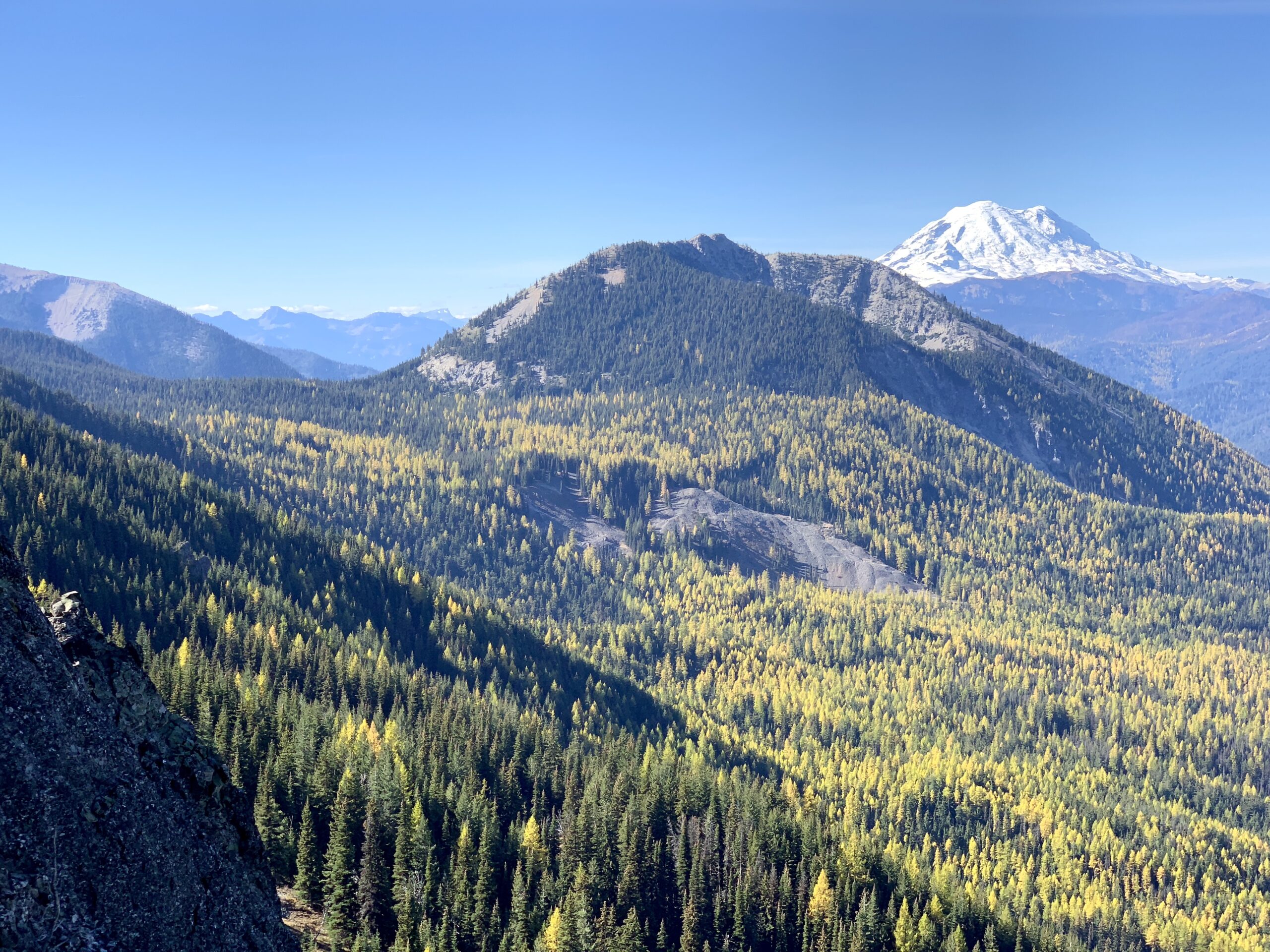
This is a 366 mile long route that offers the intermediate and advanced rider a taste of almost every kind of adventure riding available in the Central Cascades. From bombing down thickly forested lanes near Lester to riding the shelf roads on your way to 410 to bouncing through the wide-open rocks of the Colockum Green Dot Roads. Mossy rain forest to dry Ponderosa to sub-Alpine vistas full of larches. This ride has everything. If you are thinking of riding the WABDR, this would be a great way to test yourself. It is suitable for a big bike.
Notes:
Near the beginning of the route, the track shows two ways through the Stampede Pass area. The preferred route goes through the middle of the area while an easier route goes around. The preferred route is much better riding – swoopy, twisty with easy obstacles, lonely and some beautiful scenery. The easier route is also beautiful and much faster riding albeit more ‘crowded.’
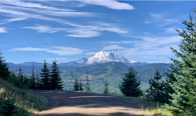
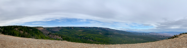
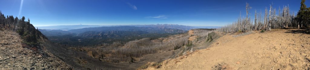
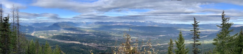
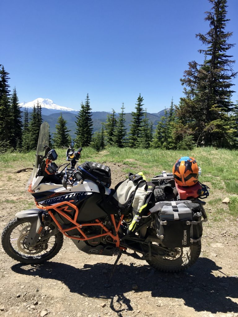
The viewpoint at the top of Little Bald Mountain (SW of Cliffdell) is not to be missed. Its a rocky climb but worth it.
Unless you are in a hurry, the route around Blewett Pass is a must. Ride the track counterclockwise. The first leg is unpaved and goes by many old mining claims. The second leg is paved (albeit roughly in spots) and one of the best twisty roads in the state.
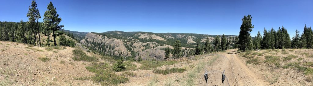
The most technically challenging part of the ride is a series of gullies west of Mission Ridge. They are pretty easy but you don’t want to stop on your way out of the gully. Video.
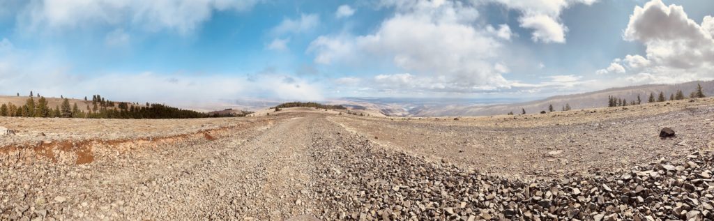
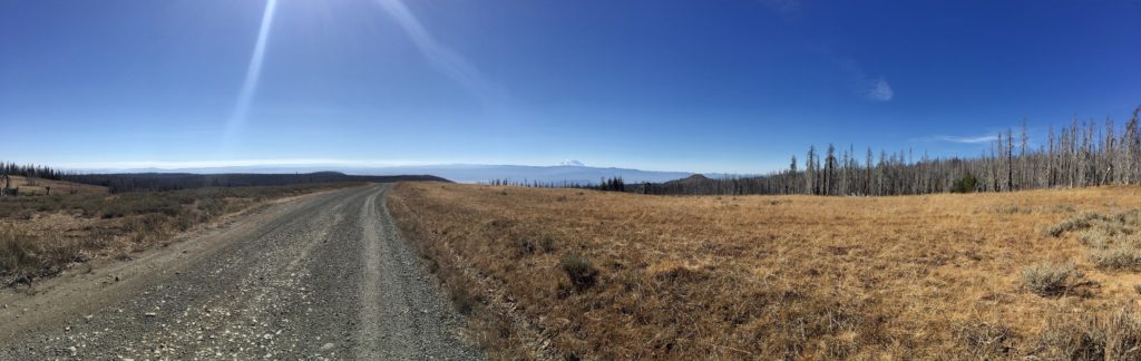
Prepare for riding rocky terrain. All of the areas north of Nile and NE of Ellensburg are rocky. Mostly chicken heads and baby heads (indicate size of rock) and not rock gardens (really big rocks, often loose). What does this mean to you? Get a good nights sleep, rest when you feel tired and most importantly: keep your head up, your eyes looking ahead and keep your speed.
North Fork Snoqualmie
The quintessential Seattle, Eastside warmup ride. Heading straight out of North Bend and heading north along the Cascades, this ~60 mile ride is fun for beginners on up.
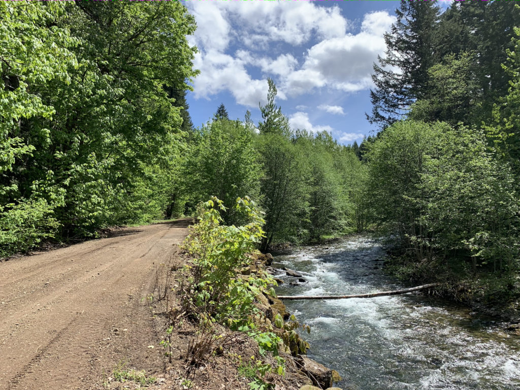
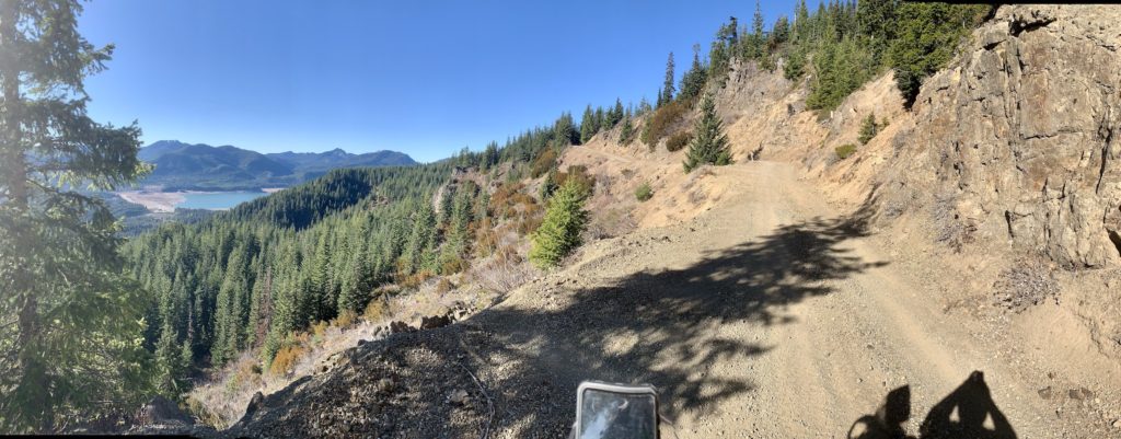
The first half of the ride down FR57 passes through Hancock timber lands and provides some amazing vistas because everything around you is clearcut. The second part of the ride is more of the typical PNW ‘tunnel o’ trees’ but the crossings of the North Fork of the Snoqualmie River are stunning.
The road forks near the end: Go right and you continue down 57. This is an easy, narrow road and well worth the ride along the beautiful Lennox Creek.
Go left on FR 5733 and the going gets a little rockier and ruttier. Fun but a dead end. There is a spur road (FR 5736) on the left around halfway down this fork that is well worth your time. I would say its best for intermediates because of a large number of uphill rocks at the beginning. The road will reward you will some tiny creek crossings and an incredible vista at the end.
A word of warning about this ride: because of ease of access, proximity to a population center and the curvy nature of the road, the biggest danger to you is other people. Expect traffic on this road and expect it to behave badly by driving too fast, cutting corners, etc.
Oh, and try not to ride it the one day each spring when they grade the road. I seem to do this every year and its like riding on ice, snow and thick mud all at the same time.


the Loctite Tour
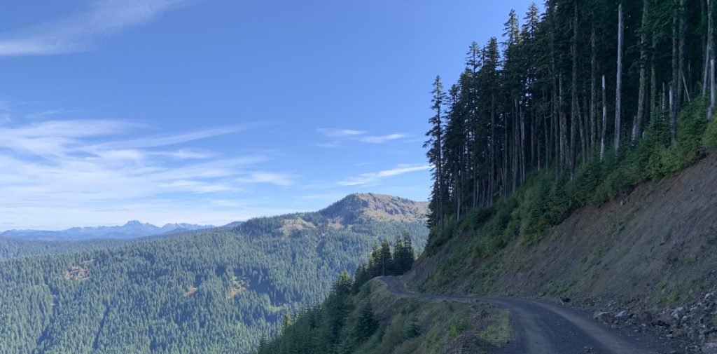
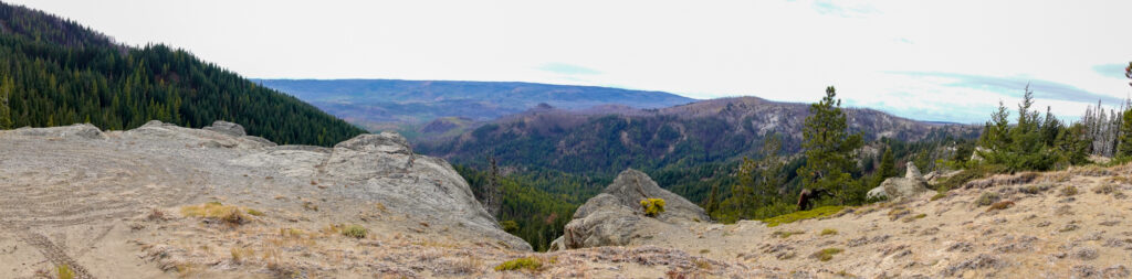
This is a challenging ride for any size bike but worth it for the views over the Taneum area from the numerous balds along the route. I would say intermediate rider and up. A steering damper helps on a ride like this.
The challenge comes from the zillions of rocks you are going to ride over on the Northern part of the route. That said, if you are a veteran of Section 2 of the WABDR, this section will pose no problems whatsoever.
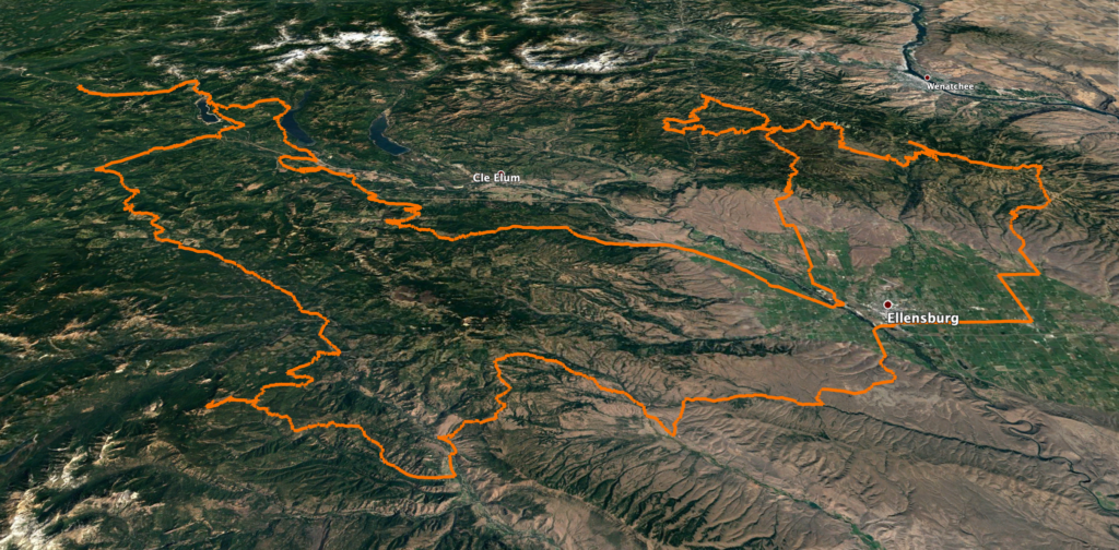
This 166 mile route starts in Cle Elum. Check out some of the other routes, particularly the Central Cascades Sampler, if you want to see some more interesting ways of getting to and from the route.


Central Cascades Sampler
This is a big-bike friendly albeit big-bike challenging route from Easton to Cle Elum. It’s one of my favorite rides because of the diversity of terrain, loneliness of the route and damn fun riding.
I’d say it’s best for intermediates and above. Some parts of the middle section of two-track are rocky with well-spaced water bars that make fun jumps. There is an easy (6”) creek crossing.
Near Easton, I have included a very short alternative route on an unnamed road that parallels Tucker Creek. This is a really fun and relatively short section of narrow double track. The most technical part is the multiple small stream crossings. There are steep, five foot climbs out. You have to commit, don’t be in the backseat and give it some gas! A lot more fun on a smaller bike.
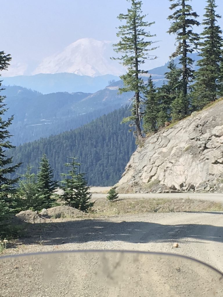
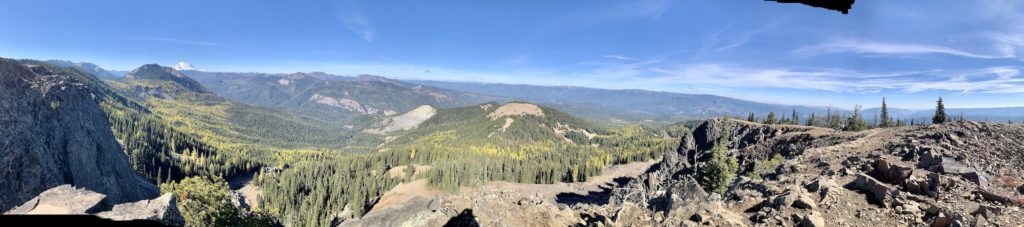
Make sure you take the slight detour (NF1600 – Little Bald Mountain) to the photo waypoint around mid-ride. It’s a great lunch spot and has an absolutely stunning view of the valley 3000ish feet below. Same goes for the FR 4510 photo waypoint as you approach the descent into the Cle Elum area. ~250 miles.


the S in Snoqualmie
This is a big-bike friendly 23 mile route that offers some stunning scenery, fun riding, isn’t far from home, doesn’t take long and can be used to access other routes. Whats not to like?
It’s an easy route and will work for beginners. That said, watch out for loose rock on the numerous up and downhill hairpins. Also, there is small rutted section around 5-10 minutes into the descent to Lake Kachess. They are not huge ruts – just make sure to look where you want to go and not at the ruts.
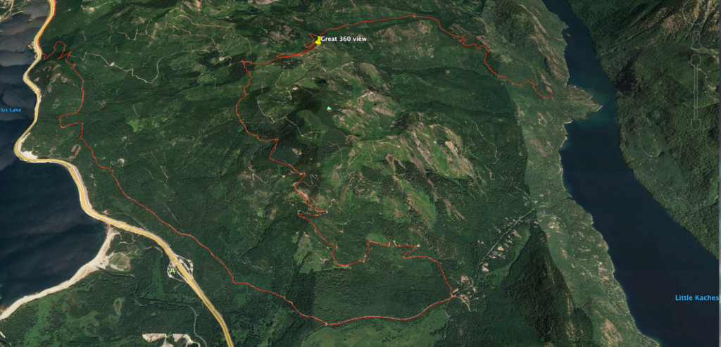
The route ends at NF-49, a paved road. From here you can check out the dead-end road to Hibox peak, head back to 90 or continue on to Stampede Pass on the south side of the freeway.
Triple Loopalooza
This is a big-bike friendly route from Exit 42 on I-90 (Tinkham Rd) over Snoqualmie, Stampede, and Tacoma Passes. The route passes near Windy Gap, Pyramid Peak and the Naches Trail.
I’d say it’s best for advanced beginners and above. There is a rocky climb from the southeast end of the Stampede Loop up to the high shelf roads that parallel the PCT – rd 7036. There isn’t that much loose rock. You just need to be comfortable picking a line and sticking to it.
The route is 151 miles long with 30k ft of ascent/descent. There are numerous escape routes including Greenwater and FR19 to Clifdell.